Stronger disaster response for the Philippines
Planning by the authorities of the Philippines for mitigation of the effects of natural disasters and major accidents will be supported by a collaboration with the European Union Earth observation program, Copernicus.
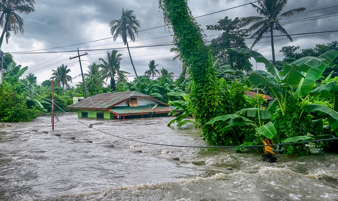
The Philippines already use satellite images to monitor the situation of remote communities in the aftermath of disasters such as typhoons and accidents like oil spills. The National Copernicus Capacity Support Action (CopPhil) program will further enhance these efforts through use of environment and climate data from the European Sentinel satellite constellation and other Earth observation satellites.
In the Philippines, the program is anchored at the Philippine Space Agency (PhilSA) and at DOST (the Department of Science and Technology) also operating PREGINET, the national research and education network (NREN).
Supporting decision-making
“Through the DOST-Advanced Science and Technology Institute (ASTI) and DOST-Philippine Institute of Volcanology and Seismology (PHIVOLCS), we have been implementing activities as well as further research for ground motion monitoring, flood detection, and flood extent mapping. We have also been utilizing Sentinel datasets for landcover mapping, aquaculture monitoring, and even forest and watershed management monitoring around the Philippines,” says DOST Secretary Renato U. Solidum, Jr.
He further notes that the agency wants to make use of the Copernicus observation satellites and ground-based data information systems to support the Philippine government’s capacities for planning and decision-making.
Operationally, many of the facilities and ground infrastructures being used for this program are still with DOST.
Pioneer program for Asia Pacific
Copernicus is a European Union program aimed at developing European information services based on both satellite Earth observation and in-situ data. The program is coordinated by the European Commission and implemented in partnership with the EU member states, the European Space Agency (ESA), the European Organization for the Exploitation of Meteorological Satellites (EUMETSAT), the European Centre for Medium-Range Weather Forecasts, EU Agencies, and Mercator Océan.
The Copernicus Services deliver near-real-time data on a global level which can also be used for local and regional needs.
The collaboration with the Philippines is supported by the European Commission’s Technical Assistance and Information Exchange Instrument (TAIEX). The instrument promotes interactions and technical exchanges between EU member states administrations and those in partner countries.
The Philippines has agreed with the EU to increase cooperation on Disaster Risk Management in the continuous development and implementation of measures to reduce risk to communities, as well as manage the consequences of natural disasters across all levels of society. The collaboration is the first of its kind in the Asia Pacific region.
The text is inspired by the article “First in the Region: Philippines, EU join forces for CopPhil Implementation, strengthens disaster response” by Neyzielle Ronnicque at the DOST-ASTI website.
For more information please contact our contributor(s):